This page is intended for the planning committee. We will be posting material used in the preparation for our community meetings and Capstone Tsunami Evacuation Drill. If you are part of the community and want to get involved, please focus you attention on the main page set up for the community at large. This page is intended to be used solely by the planning committee.
Please contact me if you have any questions at “quakejay at gmail.com”
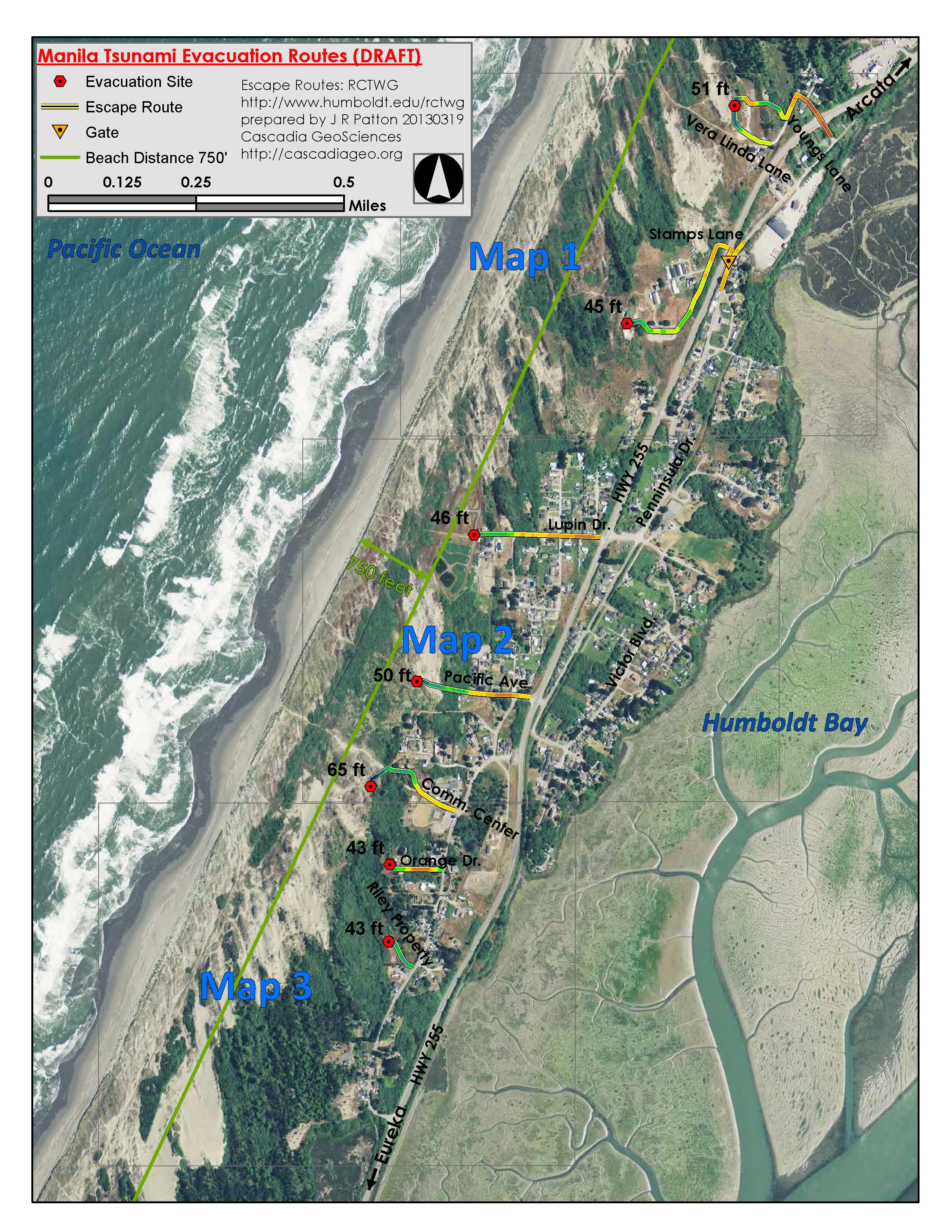
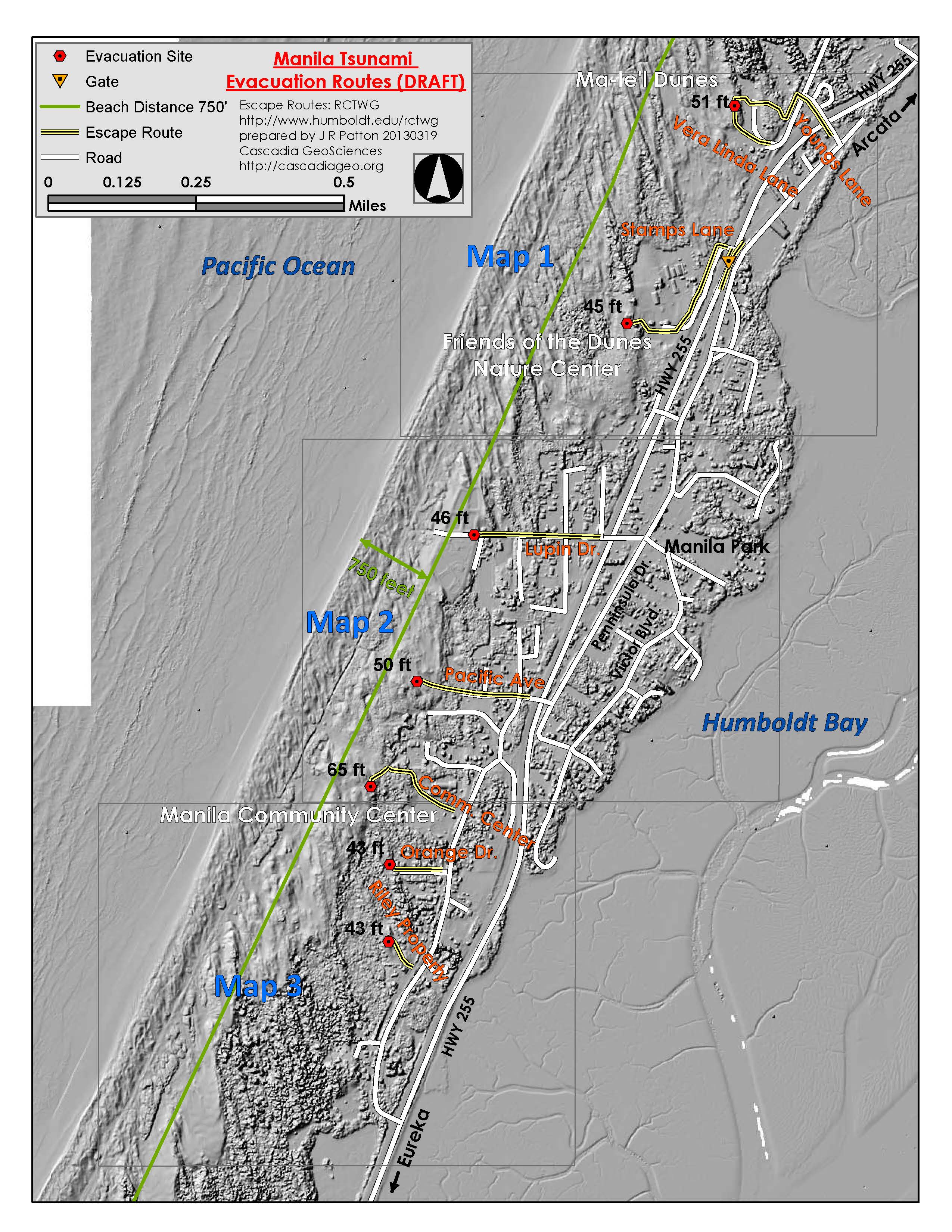
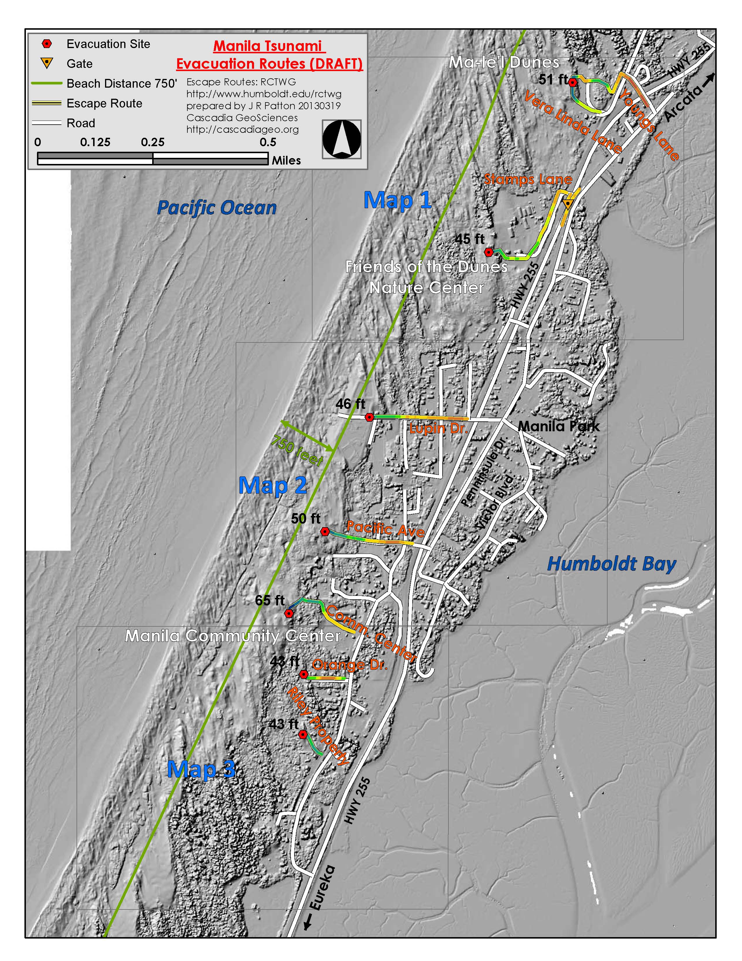
Maps:
Draft Route map: Version 1 Imagery Single Color Route (1.5MB pdf)

Draft Route map: Version 2 Imagery Elevation Color Route (1.7MB pdf)
Draft Route map: Version 3 Hillshade Single Color Route (1.2MB pdf)
Draft Route map: Version 4 Hillshade Elevation Color Route (1.7MB pdf)
<!–
Draft Route map with Elevation Contours (23MB pdf)

Draft Route map with Elevation Contours (low resolution) (4MB pdf)
